
Details
Dominica was the last Caribbean island to be colonized by the Europeans, due in part to its rugged topography, and the fierce resistance of the native Carib Indians. Approximately 3,000 Carib descendants still live on the island.
The British took control in 1763, and Dominica became a colony in 1805, finally gaining total independence in 1978.
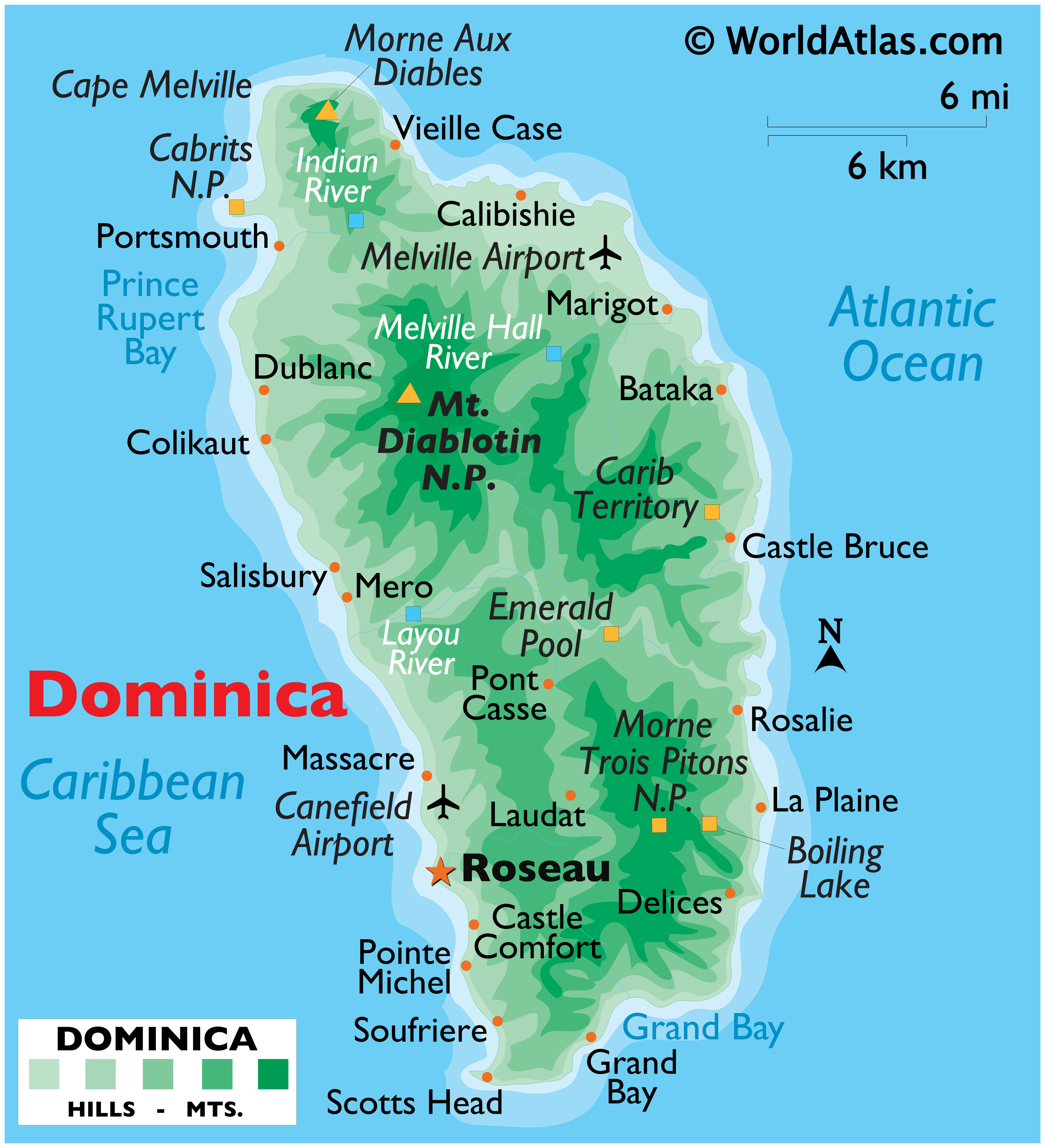
Called the "Nature Island," Dominica is certainly that, and much more. It's literally covered with thick green jungle, punctuated by sharp-edged volcanic peaks, mountains, lakes, rivers, hot springs and waterfalls and a wide variety of green vegetation and wildlife.
It's a popular cruise ship destination, and a magnet for hikers and nature enthusiasts. The offshore reefs attract divers from around the world.
Agriculture is the major industry here, followed closely by tourism. Travelers fortunate to visit this Eden will tell you that Dominica is a true paradise, wonderfully preserved for all to see.
Official Name: Commonwealth of Dominica
Population: 70,500
Capital City: Roseau (20,000)
Languages: English (official)
Official Currency: East Caribbean Dollar
Land Area: 290 sq miles (750 sq km)
Latitude/Longitude: 15º 25N, 61º 20W
Highest Point: Mt. Diablotin, 4,747 ft. (1,447m)
The village of St. Joseph where I live is located between the Layou River and Mero on the West Coast. Hope you enjoyed this little factual tidbit about where I am.
No comments:
Post a Comment